





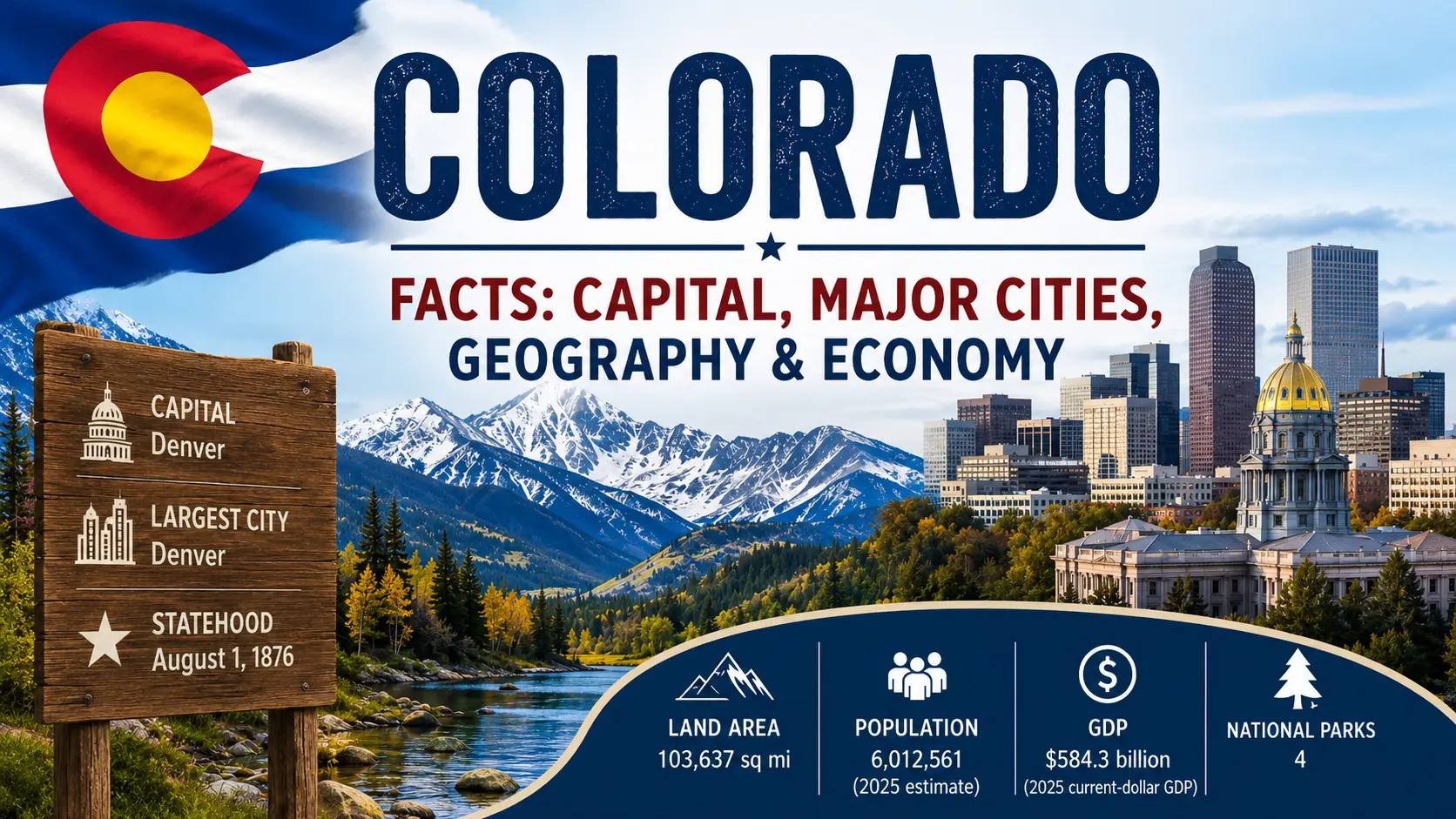
Colorado is a state of striking contrasts. Snow-covered Rocky Mountain peaks rise above broad valleys, while the eastern third of the state opens onto the Great Plains. Denver is a major city and transportation center, yet large parts of western Colorado are made up of mountains, forests, canyons, plateaus, and small communities.
Those landscapes have shaped Colorado’s history and its economy. Mining helped bring waves of newcomers in the nineteenth century. Farming and ranching remain important, especially on the plains and in western valleys. Today, technology, aerospace, tourism, energy, healthcare, finance, manufacturing, agriculture, and federal research all have substantial roles in the state.
This guide covers the essential facts about Colorado, including its capital, major cities, geography, population, economy, GDP, history, national parks, landmarks, and state symbols.
Quick Facts About Colorado
| Fact | Colorado |
|---|---|
| Official name | State of Colorado |
| Postal abbreviation | CO |
| Capital | Denver |
| Largest city | Denver |
| Region | Western United States |
| Statehood | August 1, 1876 |
| Order of statehood | 38th state |
| Nickname | The Centennial State |
| State motto | Nil Sine Numine — commonly translated as “Nothing Without the Deity” |
| Land area | About 103,637 square miles |
| Population | 6,012,561 — U.S. Census Bureau estimate for July 1, 2025 |
| Counties | 64 |
| Highest point | Mount Elbert |
| Highest-point elevation | 14,433 feet according to the U.S. Geological Survey elevation table |
| Major rivers | Colorado, Arkansas, South Platte, Rio Grande |
| State bird | Lark bunting |
| State flower | Columbine |
| State tree | Blue spruce |
| State animal | Rocky Mountain bighorn sheep |
| Time zone | Mountain Time |
Colorado is known as the Centennial State because it entered the Union in 1876, one hundred years after the Declaration of Independence was adopted in 1776. President Ulysses S. Grant signed the proclamation admitting Colorado as the 38th state on August 1, 1876.
Where Is Colorado Located?
Colorado is in the western United States, between the Great Plains and the interior mountain-and-plateau regions of the West. Wyoming lies to the north, Nebraska and Kansas are to the east, Oklahoma and New Mexico are to the south, and Utah is to the west.
Colorado also meets Arizona at the Four Corners. Colorado and Arizona do not share a normal border line; instead, their boundaries touch at a single point where Colorado, Utah, Arizona, and New Mexico meet.
Colorado on the U.S. Map
On a map, Colorado looks almost rectangular. Its borders were defined largely by lines of latitude and longitude rather than rivers or mountain ridges. That simple outline hides a state with enormous differences in elevation, climate, vegetation, and land use.
The eastern plains are relatively flat or gently rolling. Moving west, the land climbs sharply toward the Front Range and the Rocky Mountains. Beyond the Continental Divide, western Colorado contains valleys, high plateaus, mesas, canyons, and mountain ranges.
What States Border Colorado?
Colorado shares conventional state borders with Wyoming, Nebraska, Kansas, Oklahoma, New Mexico, and Utah. Arizona touches Colorado only at the Four Corners point.
How Large Is Colorado?
Colorado has about 103,637 square miles of land and roughly 458 square miles of water. The U.S. Census Bureau ranks it as the eighth-largest state by area.
Its size becomes easier to understand when geography is considered with it. A trip across Colorado can pass through grasslands, foothills, alpine mountains, forested valleys, dry plateaus, and canyon country without leaving the state.
Geography of Colorado
Mountains dominate the popular image of Colorado, but they are only part of the state. Colorado’s geography includes the Great Plains, several ranges of the Rocky Mountains, broad intermountain valleys, the Colorado Plateau, deep river canyons, and semi-arid western landscapes.
Major Geographic Regions of Colorado
Eastern Colorado belongs to the Great Plains. This region includes grasslands and much of the state’s important agricultural land. Elevation gradually rises as the plains approach the Rocky Mountains.
The Front Range forms the eastern edge of the Southern Rocky Mountains. It is also closely associated with Colorado’s main population corridor, where cities such as Fort Collins, Denver, Boulder, Colorado Springs, and Pueblo are located in or near the transition between plains and mountains.
Farther west are high mountain ranges and large valleys. The Western Slope drains mainly toward the Colorado River and includes places such as Grand Junction, the Grand Valley, ski communities, ranching areas, orchards, and rugged canyon country.
Southwestern Colorado also reaches into the Colorado Plateau, a region known for mesas, canyons, cliffs, and archaeological landscapes. Mesa Verde National Park is one of its best-known places.
The Rocky Mountains in Colorado
The Rocky Mountains run through central Colorado and have shaped nearly every part of the state’s development. They influence climate, rivers, transportation routes, settlement patterns, tourism, recreation, and water supply.
Among Colorado’s major mountain groups are the Front Range, Sawatch Range, Sangre de Cristo Mountains, San Juan Mountains, Elk Mountains, and Park Range. High passes provide road connections through terrain that historically made travel difficult.
Colorado’s Highest Mountains
Mount Elbert is the highest point in Colorado and the highest summit in the Rocky Mountains of North America. The U.S. Geological Survey lists its elevation at 14,433 feet.
Colorado is famous for its many mountains above 14,000 feet, commonly called fourteeners or 14ers. Mount Massive, Mount Harvard, Blanca Peak, Uncompahgre Peak, Grays Peak, Torreys Peak, Longs Peak, and Pikes Peak are among the state’s well-known high summits.
Rivers and Lakes of Colorado
Colorado is an important headwaters state. Snow and rainfall in its high mountains feed river systems that carry water far beyond its borders.
The Colorado River begins in the Rocky Mountains and flows west, eventually crossing several states on its way toward Mexico. The South Platte River drains much of northeastern Colorado and passes through the Denver area. The Arkansas River begins in central Colorado and flows east across the plains, while the Rio Grande rises in the San Juan Mountains and flows south through the San Luis Valley.
These rivers support cities, farms, ecosystems, reservoirs, recreation, and water users outside Colorado. That makes mountain snowpack and water management important far beyond the state line.
Colorado’s Climate
Colorado does not have one uniform climate. Elevation is one of the biggest reasons.
Eastern Colorado has a continental, semi-arid climate with warm summers, cold winters, strong temperature changes, and periodic thunderstorms. High mountain areas are much colder and receive heavy winter snowfall. Valleys can have their own local temperature patterns, while much of western Colorado is relatively dry.
Weather can also change quickly in the mountains. Elevation affects temperature so strongly that conditions at a high pass or summit may be very different from those in a nearby lower valley.
Natural Resources of Colorado
Colorado’s natural resources include forests, rangeland, agricultural soils, rivers, minerals, oil, natural gas, wind, and solar resources. Gold and silver played major roles in the state’s nineteenth-century history, while energy extraction remains important in some areas today.
Water may be the state’s most widely shared natural resource challenge. Cities, agriculture, ecosystems, neighboring states, and downstream users all depend on water that begins or passes through Colorado.
What Is the Capital of Colorado?
Denver is the capital of Colorado. It is also the state’s largest city and the center of its largest metropolitan area.
Denver serves as Colorado’s political center, but its importance reaches well beyond state government. The city is a major center for transportation, finance, professional services, healthcare, tourism, technology, culture, and regional commerce.
About Denver
Denver sits just east of the main Rocky Mountain foothills along the South Platte River. Its location helped it grow as a gateway between the Great Plains and the mountain West.
The U.S. Census Bureau estimated Denver’s population at 740,613 on July 1, 2025. Its metropolitan influence extends much farther through surrounding communities in Adams, Arapahoe, Jefferson, Douglas, Broomfield, and other counties.
Why Is Denver Called the Mile High City?
Denver is called the Mile High City because its elevation is about one mile above sea level. The nickname is closely tied to the city’s identity and its location near the eastern base of the Rocky Mountains.
Why Did Denver Become Colorado’s Capital?
Denver grew quickly after gold discoveries brought miners and merchants to the region beginning in the late 1850s. Its position as a supply, transportation, and commercial center strengthened as roads and rail connections developed.
Denver became the permanent seat of Colorado’s territorial government in 1867. When Colorado became a state in 1876, Denver continued to serve as the center of state government and later became the permanent state capital.
Major Cities in Colorado
Most Coloradans live in urban areas, especially along the Front Range. Denver is by far the largest city, but several other cities serve important regional, educational, military, agricultural, and economic roles.
| City | 2025 population estimate | Known for |
|---|---|---|
| Denver | 740,613 | State capital, transportation, finance, services, technology |
| Colorado Springs | 494,743 | Military and space activity, tourism, Pikes Peak |
| Aurora | 410,053 | Healthcare, aerospace, Denver metropolitan economy |
| Fort Collins | 171,500 | Colorado State University, technology, brewing, agriculture |
| Lakewood | 156,927 | Denver-area employment, federal offices, residential economy |
| Thornton | 147,766 | Growing northern Denver metropolitan community |
| Greeley | 115,073 | Agriculture, food processing, University of Northern Colorado |
| Pueblo | 110,404 | Steelmaking history, manufacturing, agriculture, southern Colorado services |
| Boulder | 105,689 | University of Colorado, research, technology, outdoor recreation |
| Grand Junction | 71,827 | Western Colorado healthcare, services, agriculture, energy, tourism |
Denver
Denver combines the roles of state capital and major regional city. Its economy includes government, finance, professional services, healthcare, technology, transportation, tourism, construction, and many other industries. Denver International Airport also makes the region a major air-transportation hub.
Colorado Springs
Colorado Springs lies south of Denver near Pikes Peak. Military and aerospace activities are especially important to the local economy. The area is home to the U.S. Air Force Academy as well as major defense and space installations.
Tourism is important too. Pikes Peak, Garden of the Gods, mountain scenery, trails, and other attractions bring visitors to the region throughout the year.
Aurora
Aurora is part of the Denver metropolitan area and extends across several counties. Healthcare is one of its strongest sectors, helped by the Anschutz Medical Campus and surrounding medical and life-science activity. Aerospace, defense, retail, services, and transportation also matter to the city’s economy.
Fort Collins
Fort Collins is the major urban center of northern Colorado. Colorado State University gives the city a strong educational and research presence. Technology, bioscience, manufacturing, agriculture, food and beverage production, and professional services all contribute to the local economy.
Boulder
Boulder is smaller than Denver or Colorado Springs but has an outsized role in research and technology. The University of Colorado Boulder, federal laboratories, scientific institutions, startups, and established technology companies make the city an important research center.
Pueblo and Grand Junction
Pueblo is an important center for southern Colorado and has a long connection with steel and manufacturing. Agriculture, healthcare, transportation, education, and public services also support the regional economy.
Grand Junction plays a similar regional role on the Western Slope. It serves as a center for healthcare, shopping, education, transportation, and services across a large part of western Colorado. Nearby agriculture is known for fruit growing and vineyards, while energy and outdoor recreation also influence the regional economy.
Population of Colorado
The U.S. Census Bureau estimated Colorado’s population at 6,012,561 on July 1, 2025. That was about 4.1 percent higher than the Census Bureau’s April 2020 estimates base.
Colorado ranked 20th among the 50 states by population in the Census Bureau’s 2025 estimates.
Where Do Most Coloradans Live?
Colorado’s population is not spread evenly across the state. A large share lives along the Front Range Urban Corridor, stretching from the Fort Collins area through Denver and Colorado Springs toward Pueblo.
This corridor sits near the eastern edge of the Rocky Mountains, where plains and foothills meet. It contains the state’s biggest concentrations of jobs, universities, transportation infrastructure, healthcare systems, and housing.
Urban and Rural Colorado
Outside the main metropolitan corridor, Colorado includes extensive rural areas. The Eastern Plains contain farming and ranching communities separated by long distances. Mountain counties include resort towns as well as small historic communities. Western Colorado has regional centers such as Grand Junction but also large areas with low population density.
This uneven settlement pattern is one of the clearest links between Colorado’s geography and its population.
Economy of Colorado
Colorado’s economy is much broader than the skiing, tourism, and mining images often associated with the state. Those activities matter, but so do technology, aerospace, professional services, healthcare, finance, government, manufacturing, energy, agriculture, transportation, research, and education.
The mix also changes from one part of Colorado to another. The Denver metropolitan area has a large service economy. Boulder has a strong research and technology base. Colorado Springs is closely tied to defense and space activity. The Eastern Plains depend more heavily on agriculture and energy, while many mountain communities rely strongly on tourism and recreation.
Major Industries in Colorado
The Colorado Office of Economic Development and International Trade identifies major sectors that include advanced manufacturing, aerospace, bioscience, defense, electronics, energy and natural resources, financial services, food and agriculture, health, technology and information, tourism, outdoor recreation, and transportation and logistics.
Technology Industry
Technology companies and research institutions are concentrated heavily along the Front Range. Denver and Boulder are especially important for software, telecommunications, data services, startups, and research. Fort Collins and Colorado Springs have technology sectors of their own.
Federal laboratories and research universities add another layer. Colorado has strong links between higher education, government research, and private companies working in fields such as computing, renewable energy, telecommunications, semiconductors, bioscience, and advanced engineering.
Aerospace and Defense
Aerospace is one of Colorado’s most distinctive high-technology industries. The state has a large concentration of aerospace companies, military installations, federal laboratories, and space-related organizations.
Colorado Springs is especially important. The area is home to the U.S. Air Force Academy, major Space Force operations, the North American Aerospace Defense Command, U.S. Northern Command, and other military activities. Aerospace companies are also spread across the Denver-Boulder corridor and elsewhere along the Front Range.
Tourism and Outdoor Recreation
Colorado’s mountains turn geography into an economic asset. Ski resorts, national parks, hiking trails, rafting rivers, climbing areas, mountain-bike routes, campgrounds, scenic highways, and historic towns support tourism throughout the state.
Winter sports are particularly visible, but Colorado is not a one-season destination. Summer hiking, camping, fishing, cycling, rafting, sightseeing, and national-park travel are major parts of the visitor economy.
Energy Industry
Colorado produces oil and natural gas and has a long history of mining. At the same time, wind and solar power have become increasingly important parts of the state’s energy system.
The energy picture differs by region. Oil and gas activity is especially significant in parts of northeastern and western Colorado, while wind development is prominent on the plains. The state is also home to research connected with renewable energy and energy technology.
Agriculture in Colorado
Agriculture may be less visible to visitors than mountains and ski resorts, but it remains a major part of Colorado’s land use and rural economy. The Colorado Department of Agriculture identifies cattle and calves as the state’s leading agricultural commodity.
Other important products include dairy, corn, wheat, hay, potatoes, vegetables, and specialty crops. Northeastern Colorado is a major agricultural area, while the San Luis Valley is well known for potatoes. Western Colorado produces fruit, including peaches, as well as wine grapes and other crops suited to local valleys.
The Colorado Department of Agriculture says agriculture contributes about $47 billion to the state’s economy and is connected to roughly 30 million agricultural acres.
Manufacturing
Colorado manufacturing ranges from food processing and beverages to aerospace components, electronics, machinery, medical products, and advanced materials. Pueblo’s steelmaking history is one well-known example, while the Front Range supports many newer forms of high-skill manufacturing.
Colorado GDP
Gross domestic product, or GDP, measures the value of goods and services produced within an economy. For a state, it gives a broad measure of the size of that state’s economy.
What Is Colorado’s GDP?
According to U.S. Bureau of Economic Analysis data, Colorado’s current-dollar GDP was about $584.3 billion in 2025. Current-dollar GDP measures output using prices from the period being measured, so it is useful for describing the economy’s dollar size.
Colorado’s real GDP was about $458.1 billion in 2025 when measured in chained 2017 dollars. Real GDP adjusts for price changes, making it more useful for comparing economic output across years. Real GDP increased about 2.1 percent from 2024 to 2025.
It is important not to mix these two measures. The $584.3 billion figure is current-dollar GDP, while the $458.1 billion figure is inflation-adjusted real GDP.
Which Industries Contribute to Colorado’s GDP?
No single industry defines Colorado’s economy. Real estate, professional and business services, information, finance, healthcare, government, manufacturing, construction, trade, and other service industries all contribute. Aerospace, tourism, energy, and agriculture are especially important to particular regions and to Colorado’s public identity.
Colorado GDP Per Capita
GDP per capita divides economic output by population. It can help compare economies of different sizes, but it should not be confused with average salary, household income, or the amount of money an individual resident receives.
Using Colorado’s 2025 current-dollar GDP and its July 2025 population estimate gives a simple ratio of roughly $97,000 of GDP per resident. Because annual GDP and a single-date population estimate measure slightly different periods, this figure is best treated as an approximate comparison rather than personal income.
Natural Resources and Water in Colorado
Water connects Colorado’s mountains, cities, farms, and neighboring states. Much of the state’s precipitation falls as mountain snow. When that snow melts, it feeds streams and rivers that support communities both inside and outside Colorado.
Why Colorado Matters to Western U.S. Water Supplies
Several major river systems begin in Colorado. Water from the Colorado River basin flows toward the Southwest, while the South Platte and Arkansas systems carry water east. The Rio Grande flows south from the San Juan Mountains.
Because so many people and farms depend on these rivers, water allocation is a major issue in Colorado. Reservoirs, irrigation systems, interstate agreements, municipal supplies, conservation, drought, and snowpack all become part of the same discussion.
The Colorado River
The Colorado River begins in the Rocky Mountains of Colorado and flows west through the state before continuing into Utah and the wider Colorado River Basin. Along the way, it provides water for communities, agriculture, ecosystems, recreation, and hydropower systems across the West.
That makes the river far more than a geographic feature. It is also a shared economic and environmental resource.
Brief History of Colorado
Colorado’s history did not begin with miners, railroads, or U.S. statehood. Indigenous peoples have lived in and traveled through the region for thousands of years. Later periods brought Spanish and Mexican influence, U.S. expansion, mining rushes, forced displacement, railroads, farming, industrial development, tourism, and rapid urban growth.
Indigenous Peoples of Colorado
The Ute people have one of the deepest continuing connections to the land now called Colorado. Ute oral traditions place their people in these homelands from time immemorial. Today, the Southern Ute Indian Tribe and Ute Mountain Ute Tribe are based in southwestern Colorado, while the Ute Indian Tribe of the Uintah and Ouray Reservation is based in Utah.
Cheyenne, Arapaho, Apache, Comanche, Pueblo peoples, and other Indigenous nations also have important histories connected with areas that became Colorado. Trade, migration, hunting, diplomacy, conflict, and changing territorial relationships linked the plains, mountains, and Southwest long before modern state boundaries were drawn.
Spanish and Mexican Influence
Spain claimed large areas of the interior Southwest, including parts of what later became Colorado. After Mexico gained independence from Spain in 1821, southern Colorado became part of Mexican territory.
Land grants, trade routes, settlements, and families tied southern Colorado closely to New Mexico. That history remains visible in the San Luis Valley and other parts of southern Colorado, where Spanish and Mexican cultural influences are older than Colorado statehood.
U.S. Expansion and Territorial Change
The land that became Colorado did not enter the United States through a single territorial transfer. Different sections were connected to the Louisiana Purchase, the annexation of Texas, and lands transferred after the Mexican-American War.
Before Colorado Territory was created, parts of the future state were administered under several other U.S. territories. The modern state brought pieces of those earlier jurisdictions together.
The Colorado Gold Rush
Gold discoveries near the South Platte River and in the mountains triggered a major rush of settlers beginning in 1858 and 1859. The movement is often associated with the slogan “Pikes Peak or Bust!”, even though many mining areas were far from Pikes Peak itself.
The gold rush accelerated the growth of Denver and nearby settlements and helped create pressure for a formal U.S. territory. Mining camps appeared quickly in mountain areas, and merchants, transportation businesses, farms, and services grew around them.
This expansion also brought severe consequences for Indigenous peoples, including loss of land, broken agreements, armed conflict, and forced removal. Those events are essential to understanding Colorado’s nineteenth-century history rather than treating settlement as an empty-land story.
Colorado Territory
Congress created the Colorado Territory in 1861. The territory brought together land that had previously been divided among other U.S. territories.
Denver and Golden competed for political and economic influence during the territorial period. Denver became the permanent seat of the territorial government in 1867.
When Did Colorado Become a State?
Colorado became the 38th state on August 1, 1876, when President Ulysses S. Grant issued the proclamation admitting it to the Union.
Because 1876 was the centennial year of American independence, Colorado became known as the Centennial State.
Mining and Railroads
Mining remained a major force after statehood. Gold and silver discoveries supported famous mining districts and towns, while coal, lead, zinc, molybdenum, and other minerals also became economically important.
Railroads changed Colorado by connecting mines, farms, towns, and cities with larger national markets. Denver strengthened its role as a commercial hub, while rail lines reached mountain districts that had previously depended on difficult wagon routes.
Colorado in the 20th and 21st Centuries
Over time, Colorado became less dependent on mining. Agriculture, manufacturing, federal activity, military installations, universities, tourism, energy, technology, healthcare, and professional services broadened the economy.
The Front Range grew rapidly as Denver, Colorado Springs, Fort Collins, Boulder, Aurora, and surrounding communities expanded. At the same time, many mountain communities shifted toward recreation and tourism, while agriculture remained central on the plains and in several western valleys.
Government of Colorado
Colorado has the familiar three-branch structure used by U.S. state governments: executive, legislative, and judicial branches. The governor heads the executive branch, while the Colorado General Assembly makes state laws.
The General Assembly has two chambers: the Colorado House of Representatives and the Colorado Senate. The state Supreme Court sits at the top of Colorado’s judicial system.
The Colorado State Capitol in Denver houses the Senate, House of Representatives, governor’s office, lieutenant governor’s office, and other state functions.
Counties in Colorado
Colorado has 64 counties. County governments handle responsibilities that can include law enforcement, roads, land use, elections, records, and delivery of certain state and local services.
Denver is unusual because the City and County of Denver form a consolidated local government. Broomfield also operates as a consolidated city and county.
Education in Colorado
Colorado has a large network of public schools, community colleges, universities, research centers, and specialized institutions. Higher education plays an especially visible role along the Front Range.
Major Universities and Colleges
The University of Colorado Boulder is one of the state’s leading research universities. Colorado State University in Fort Collins is known for programs and research that include agriculture, veterinary medicine, engineering, natural resources, and science.
The Colorado School of Mines in Golden specializes in engineering, earth sciences, energy, minerals, and related technical fields. Other major institutions include the University of Denver, University of Colorado Denver, University of Northern Colorado, Colorado College, and the University of Colorado Colorado Springs.
The United States Air Force Academy, located near Colorado Springs, is a federal military service academy rather than a state university, but it is one of Colorado’s best-known educational institutions.
Research and Innovation
Colorado’s universities work alongside federal research facilities and private companies. Boulder and the Denver area have particularly strong concentrations of research in science, engineering, climate, communications, standards, energy, aerospace, and computing.
This research network helps explain why technology, aerospace, bioscience, and advanced manufacturing have become important parts of the modern Colorado economy.
National Parks and Famous Places in Colorado
Colorado has four national parks, each protecting a very different landscape or cultural story: Rocky Mountain, Mesa Verde, Great Sand Dunes, and Black Canyon of the Gunnison.
Rocky Mountain National Park
Rocky Mountain National Park protects high peaks, alpine tundra, forests, lakes, valleys, and wildlife in north-central Colorado. Its mountain scenery makes it one of the state’s best-known natural areas.
Trail Ridge Road crosses high alpine terrain and demonstrates how quickly Colorado’s ecosystems change with elevation.
Mesa Verde National Park
Mesa Verde National Park in southwestern Colorado protects an extraordinary cultural landscape connected with Ancestral Pueblo people. The park preserves cliff dwellings, archaeological sites, and other evidence of communities that lived in the region for centuries.
Mesa Verde is important not simply as an archaeological attraction but as part of the living heritage of Pueblo peoples whose connections to the region continue today.
Great Sand Dunes National Park and Preserve
Great Sand Dunes National Park and Preserve protects the tallest dunes in North America. The dunes rise beside the Sangre de Cristo Mountains, creating one of Colorado’s most unusual landscapes.
The surrounding protected area also includes grasslands, wetlands, forests, alpine lakes, and tundra, showing that the park is much more than a field of sand.
Black Canyon of the Gunnison National Park
Black Canyon of the Gunnison National Park protects a deep, steep-sided section of canyon carved by the Gunnison River in western Colorado. Dark rock walls, narrow canyon sections, and dramatic changes in elevation give the park its distinctive appearance.
Pikes Peak
Pikes Peak rises west of Colorado Springs and is one of the most recognizable mountains in the United States. It became closely associated with nineteenth-century western migration through the phrase “Pikes Peak or Bust!”
Today, visitors can reach the mountain by road, railway, or trail, making it one of Colorado’s most accessible famous high peaks.
Garden of the Gods
Garden of the Gods in Colorado Springs is known for towering red sandstone formations set against views of Pikes Peak. The unusual rock shapes make it one of the state’s most recognizable landscapes outside the national parks.
Red Rocks
Red Rocks near Morrison combines natural sandstone formations with an outdoor amphitheater. Its geology and music history have made it a cultural landmark as well as a scenic one.
Colorado State Symbols
Colorado has adopted many official symbols to represent its wildlife, plants, geology, culture, and history.
| Symbol | Official designation |
|---|---|
| State nickname | Centennial State |
| State motto | Nil Sine Numine |
| State bird | Lark bunting |
| State flower | Columbine |
| State tree | Blue spruce |
| State animal | Rocky Mountain bighorn sheep |
| State fish | Greenback cutthroat trout |
| State gemstone | Aquamarine |
| State mineral | Rhodochrosite |
| State rock | Yule marble |
| State fossil | Stegosaurus |
| State insect | Colorado hairstreak butterfly |
| State reptile | Western painted turtle |
| State grass | Blue grama |
| State winter sports | Skiing and snowboarding |
Several of these choices clearly reflect Colorado’s landscape. The Rocky Mountain bighorn sheep represents the high country, the blue spruce is common in mountain forests, and skiing and snowboarding reflect the state’s long association with winter recreation.
What Is Colorado Known For?
Colorado is best known for the Rocky Mountains, high elevations, ski resorts, hiking, national parks, and outdoor recreation. Denver and the Front Range add a very different side of the state, with large urban economies, universities, aerospace companies, research centers, professional services, and major transportation connections.
Colorado is also known for its mining history, fourteeners, the Continental Divide, Pikes Peak, Mesa Verde, craft brewing, cattle ranching, mountain towns, and the headwaters of major western rivers.
The state’s identity comes partly from the way these different pieces overlap. Colorado is both an urban state and a mountain state, an agricultural state and a technology center, a place shaped by ancient Indigenous histories and by rapid modern population growth.
Interesting Facts About Colorado
- Colorado became the 38th state on August 1, 1876.
- Its nickname, the Centennial State, comes from its admission to the Union during the centennial year of American independence.
- Denver is both the state capital and Colorado’s largest city.
- Colorado is the eighth-largest U.S. state by area.
- Mount Elbert is Colorado’s highest point and the highest summit in the Rocky Mountains.
- Colorado has many peaks higher than 14,000 feet, commonly called fourteeners.
- The Continental Divide crosses Colorado and separates river systems flowing toward different sides of North America.
- The Colorado, Arkansas, South Platte, and Rio Grande river systems all have important headwaters in the state.
- Colorado meets Arizona, Utah, and New Mexico at the Four Corners.
- Great Sand Dunes National Park and Preserve contains the tallest dunes in North America.
- Mesa Verde National Park preserves major Ancestral Pueblo cultural sites and is a UNESCO World Heritage Site.
- The state fossil is Stegosaurus.
- Colorado’s official winter sports are skiing and snowboarding.
- The U.S. Air Force Academy is located near Colorado Springs.
- Cattle and calves are Colorado’s leading agricultural commodity.
Colorado Facts for Students
| Question | Key fact |
|---|---|
| What is the capital of Colorado? | Denver |
| What is Colorado’s postal abbreviation? | CO |
| What is Colorado’s nickname? | The Centennial State |
| When did Colorado become a state? | August 1, 1876 |
| What number state was Colorado? | 38th |
| What is Colorado’s largest city? | Denver |
| What is Colorado’s highest point? | Mount Elbert |
| What major mountain system crosses Colorado? | The Rocky Mountains |
| How many counties does Colorado have? | 64 |
| What is Colorado’s state bird? | Lark bunting |
| What is Colorado’s state flower? | Columbine |
| What is Colorado’s state tree? | Blue spruce |
| What are some major Colorado industries? | Professional services, technology, aerospace, tourism, healthcare, energy, agriculture, manufacturing, and finance |
A useful way to remember Colorado is to connect its geography with its history and economy. The Rocky Mountains influenced mining, rivers, tourism, settlement, and transportation. The plains support agriculture. The Front Range became the main population and business corridor. Those relationships explain more than memorizing isolated facts.
Colorado MCQ Quiz
Which framework best describes Colorado as a state with a dominant Front Range core and specialized peripheral regions?
What is a likely source of agglomeration economies in the Denver-Boulder-Fort Collins corridor?
What does a core-periphery tension imply for Colorado?
How does path dependence help explain modern Colorado?
What does Colorado’s shift from extractive mining districts toward tourism and knowledge industries illustrate?
Why can Colorado be contrasted with a classic resource-dependent regional economy?
Why is physical water supply alone insufficient to explain Colorado water use?
Which water-rights doctrine is historically associated with Colorado and much of the arid West?
Why is Colorado water governance necessarily interstate?
Which set of risks belongs in long-term climate adaptation planning for Colorado?
What can rapid Front Range population growth encourage in water management?
What is a possible rural cost of transferring agricultural water to growing cities?
Why does conventional GDP understate some value produced by Colorado’s landscapes?
What is a common economic risk of heavy tourism dependence in a Colorado mountain community?
What is amenity migration in the Colorado context?
Frequently Asked Questions About Colorado
What is the capital of Colorado?
Denver is the capital of Colorado. It is also the state’s largest city and the center of its largest metropolitan area.
What is the largest city in Colorado?
Denver is Colorado’s largest city. The U.S. Census Bureau estimated its population at 740,613 on July 1, 2025.
What is Colorado famous for?
Colorado is famous for the Rocky Mountains, skiing, hiking, fourteeners, national parks, Denver, Pikes Peak, Mesa Verde, mountain scenery, outdoor recreation, and its mining history. It is also an important center for aerospace, technology, research, agriculture, and energy.
Why is Colorado called the Centennial State?
Colorado is called the Centennial State because it entered the Union in 1876, one hundred years after the United States declared independence in 1776.
What are the major cities in Colorado?
Colorado’s major cities include Denver, Colorado Springs, Aurora, Fort Collins, Lakewood, Thornton, Arvada, Westminster, Greeley, Pueblo, Boulder, and Grand Junction. Denver is the state capital and largest city.
What mountain range is in Colorado?
The Rocky Mountains cross Colorado from north to south. The state contains several ranges within the Rockies, including the Front Range, Sawatch Range, San Juan Mountains, and Sangre de Cristo Mountains.
What is the highest mountain in Colorado?
Mount Elbert is the highest mountain in Colorado. The U.S. Geological Survey lists it at 14,433 feet above sea level.
What states border Colorado?
Colorado shares conventional borders with Wyoming, Nebraska, Kansas, Oklahoma, New Mexico, and Utah. Colorado also touches Arizona at a single point at the Four Corners.
What is the population of Colorado?
The U.S. Census Bureau estimated Colorado’s population at 6,012,561 on July 1, 2025. Population estimates change over time, so the date matters when comparing figures.
What are Colorado’s major industries?
Colorado has a diverse economy that includes professional services, technology, aerospace and defense, healthcare, finance, tourism, outdoor recreation, energy, agriculture, manufacturing, construction, transportation, and government.
What is Colorado’s GDP?
Colorado’s current-dollar GDP was about $584.3 billion in 2025, according to U.S. Bureau of Economic Analysis data. Its inflation-adjusted real GDP was about $458.1 billion in chained 2017 dollars.
Does Colorado have deserts?
Colorado contains dry and semi-arid landscapes, especially in western and southern parts of the state, but it is better described as having high-desert, plateau, shrubland, and semi-arid environments rather than one large desert covering the state. Great Sand Dunes is a dune field, not a conventional hot desert.
Does Colorado border Arizona?
Colorado and Arizona touch at the Four Corners, where Colorado, Arizona, Utah, and New Mexico meet. They share a point rather than a normal border segment.
Sources and References
Population, city population, land-area, and demographic figures were checked against the U.S. Census Bureau. GDP figures were checked against the U.S. Bureau of Economic Analysis. Geographic elevations were checked against the U.S. Geological Survey. National-park information was checked against the National Park Service. Colorado government, county, state-symbol, economic, and agricultural information was checked against official Colorado state agencies and the Colorado General Assembly. Historical information was cross-checked with History Colorado and official state historical resources.
Data last reviewed: August 2026. Population estimates in this article refer to July 1, 2025 unless another date is stated. The annual GDP figures refer to 2025. Population and economic statistics are revised periodically, so date labels should remain attached to those figures when the article is updated.