





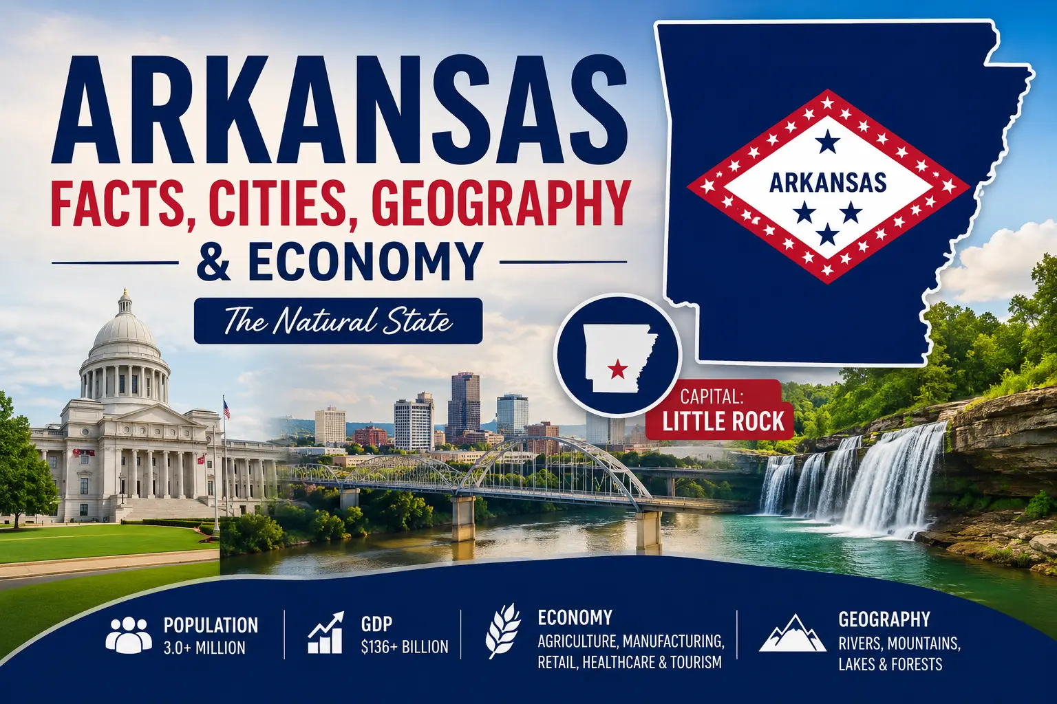
Arkansas is a state where mountain country, broad river valleys, forests, farmland, and fast-growing cities all meet. Located in the south-central United States, it stretches from the Ozark and Ouachita mountains to the flat, fertile lands along the Mississippi River. Little Rock is both the state capital and its largest city, while Northwest Arkansas has become one of the state’s busiest centers for population growth, education, retail, food production, and transportation.
Arkansas is also deeply tied to American history. It entered the Union in 1836, played an important role in the Civil War, and later became the setting for one of the defining school-desegregation struggles of the Civil Rights Movement. Today, the state’s economy mixes agriculture and manufacturing with retail, logistics, healthcare, tourism, and other services.
This guide covers the most useful Arkansas facts, including its capital, major cities, geography, population, economy, GDP, history, landmarks, state symbols, and facts students are likely to encounter in school or general-knowledge quizzes.
Quick Facts About Arkansas
| Fact | Arkansas Information |
| Official name | State of Arkansas |
| Postal abbreviation | AR |
| Capital | Little Rock |
| Largest city | Little Rock |
| U.S. region | South; West South Central Division |
| Statehood | June 15, 1836 |
| Order of admission | 25th state |
| Total area | About 53,179 square miles |
| Land area | 51,992.85 square miles, 2020 Census measurement |
| Population | 3,114,791, estimated July 1, 2025 |
| Number of counties | 75 |
| Nickname | The Natural State |
| State motto | Regnat Populus — “The People Rule” |
| State bird | Mockingbird |
| State flower | Apple blossom |
| State tree | Pine |
| Highest point | Magazine Mountain, 2,753 feet |
| Major rivers | Arkansas, Mississippi, White, Ouachita, Red |
| Time zone | Central Time |
Population figures in this article use the U.S. Census Bureau’s latest available 2025 estimates unless otherwise noted. Economic figures are dated because GDP and other measures change as new data are released.
Where Is Arkansas Located?
Arkansas lies in the south-central part of the United States. The Census Bureau places it in the South region and, more specifically, in the West South Central division. Its location gives the state features of both the upland South and the lower Mississippi Valley.
Arkansas on the U.S. Map
Arkansas sits west of the Mississippi River and north of Louisiana. The eastern side of the state belongs largely to the Mississippi lowlands, while the north and west contain much rougher country, including the Ozarks and Ouachitas.
This contrast is one of the easiest ways to understand Arkansas geography: much of the northwest and west is hilly or mountainous, while large areas of eastern Arkansas are broad, flat, and heavily used for agriculture.
What States Border Arkansas?
Arkansas shares borders with six states:
- Missouri to the north
- Tennessee to the east
- Mississippi to the east and southeast
- Louisiana to the south
- Texas to the southwest
- Oklahoma to the west
The Mississippi River forms much of Arkansas’s eastern boundary with Tennessee and Mississippi. Rivers have shaped the state’s geography, transportation, settlement, and economy for centuries.
Area and Size of Arkansas
Arkansas covers about 53,179 square miles. The 2020 Census measured 51,992.85 square miles of land. That makes Arkansas a middle-sized state by U.S. standards: large enough to contain several sharply different landscapes, but much smaller than western giants such as Texas, California, Alaska, and Montana.
Geography of Arkansas
Arkansas has much more geographic variety than its relatively modest size might suggest. A drive across the state can take you from forested ridges and clear mountain streams to wide river bottoms and flat fields that stretch toward the horizon.
Major Geographic Regions of Arkansas
Arkansas is commonly described through six major natural divisions: the Ozark Mountains, Ouachita Mountains, Arkansas River Valley, Mississippi Alluvial Plain, West Gulf Coastal Plain, and Crowley’s Ridge.
The Ozark Mountains cover much of northern Arkansas. Despite the name, much of the Ozark landscape is actually a deeply cut plateau, with steep valleys, bluffs, springs, caves, and forested hills.
The Ouachita Mountains lie farther south and have long, folded ridges that generally run east to west. This gives them a noticeably different shape from the Ozarks.
Between the Ozarks and Ouachitas lies the Arkansas River Valley, which follows the Arkansas River across the western and central parts of the state.
Eastern Arkansas is dominated by the Mississippi Alluvial Plain, often called the Arkansas Delta. It is one of the flattest parts of the state. Rivers deposited deep layers of sediment there over long periods, creating fertile soils that support large-scale farming.
Southern Arkansas includes the West Gulf Coastal Plain, a lower, gently rolling region with extensive forests as well as deposits of sand, gravel, clay, petroleum, and other resources.
Crowley’s Ridge is the geographic oddity in the east. It rises above the otherwise flat Mississippi Alluvial Plain as a long, narrow belt of hills extending through eastern Arkansas.
Mountains and Arkansas’s Highest Point
Arkansas’s highest point is Magazine Mountain, usually called Mount Magazine, in Logan County. The U.S. Geological Survey lists its elevation at 2,753 feet above sea level.
Mount Magazine belongs to the Arkansas River Valley region and rises well above the surrounding landscape. The Ozark and Ouachita mountains are not especially high compared with the Rocky Mountains, but their forests, cliffs, valleys, and waterways give northern and western Arkansas a distinctly mountainous character.
Rivers and Lakes
Water is central to Arkansas geography. The Arkansas River crosses the state from west to east before joining the Mississippi. The Mississippi River forms much of the state’s eastern edge, while the White River drains a large part of northern and eastern Arkansas.
Other important rivers include the Ouachita, Red, St. Francis, Buffalo, and Saline. Arkansas also has many reservoirs and lakes used for drinking water, flood control, fishing, boating, hydroelectric power, and recreation.
Forests and Natural Landscapes
Forests cover large parts of Arkansas, especially in the Ozarks, Ouachitas, and southern pine country. In contrast, the Delta contains broad stretches of cropland. Wetlands, river bottoms, caves, bluffs, mountain forests, and clear streams add to that range of landscapes.
That natural variety helps explain the state’s best-known nickname: “The Natural State.”
Climate of Arkansas
Most of Arkansas has a humid subtropical climate. Summers are generally hot and humid, while winters are usually milder than those farther north. Elevation makes northern and mountainous parts of the state somewhat cooler than the lowlands of southern Arkansas.
Rain falls throughout the year. Thunderstorms are common, and Arkansas can experience severe weather, including tornadoes, damaging winds, hail, flooding, winter storms, and occasional ice storms.
Natural Resources
Arkansas has long drawn economic value from its soil, forests, and mineral resources. Timber remains important, especially in southern and western parts of the state. Arkansas is also known for deposits of bromine, quartz, bauxite, natural gas, and other minerals.
What Is the Capital of Arkansas?
Little Rock is the capital of Arkansas. It is also the state’s largest city and one of its main centers for government, healthcare, finance, education, transportation, and culture.
About Little Rock
Little Rock sits along the Arkansas River near the geographic center of the state. The city contains the Arkansas State Capitol and many state government offices, but its role goes well beyond politics. Hospitals, universities, banks, law firms, museums, nonprofit organizations, and a range of other employers make it a major regional center.
The U.S. Census Bureau estimated Little Rock’s population at 206,427 on July 1, 2025.
Why Did Little Rock Become the Capital?
Arkansas Post was the first capital of Arkansas Territory when the territory was created in 1819. As settlement moved westward and the population center shifted, the territorial capital was moved to Little Rock in 1821. Little Rock remained the political center when Arkansas became a state in 1836.
Major Cities in Arkansas
Arkansas does not have a single huge metropolitan city. Instead, its urban population is spread among Little Rock and several smaller regional centers. Northwest Arkansas has been especially important in recent population growth.
| City | 2025 Population Estimate | Known For |
|---|---|---|
| Little Rock | 206,427 | State capital, government, healthcare, business |
| Fayetteville | 106,623 | University of Arkansas, education, Northwest Arkansas |
| Fort Smith | 90,855 | Manufacturing, transportation, frontier history |
| Springdale | 90,685 | Food processing, poultry industry, Northwest Arkansas |
| Jonesboro | 83,296 | Education, healthcare, regional commerce |
| Rogers | 76,956 | Retail, business, Northwest Arkansas |
| Conway | 72,328 | Higher education, technology, growing central Arkansas city |
Little Rock
Little Rock remains Arkansas’s largest single city and the center of state government. Together with nearby communities in central Arkansas, it forms the state’s principal government and healthcare hub.
Fayetteville
Fayetteville is home to the University of Arkansas and has become one of the fastest-growing major cities in the state. The Census Bureau estimated 106,623 residents in 2025, up 13.1% from the city’s April 2020 population estimate base.
Fort Smith
Fort Smith sits near the Oklahoma border on the Arkansas River. Its location helped make it important to trade, military history, transportation, and the administration of federal law in the nineteenth-century borderlands. Manufacturing and logistics remain important parts of the local economy.
Springdale, Rogers, and Bentonville
Springdale, Rogers, and Bentonville are part of the fast-growing Northwest Arkansas corridor. Springdale has strong ties to poultry and food processing. Rogers has become a major commercial center. Bentonville, estimated at 63,057 residents in 2025, is known internationally as the home of Walmart’s headquarters and has also developed a strong museum and cultural presence.
Jonesboro and Conway
Jonesboro is an important center for northeastern Arkansas and home to Arkansas State University. Conway, north of Little Rock, has several colleges and universities and has grown quickly in recent decades.
Population of Arkansas
Current Arkansas Population
The U.S. Census Bureau estimated Arkansas’s population at 3,114,791 on July 1, 2025. The estimate base for April 1, 2020 was 3,011,530, meaning the state grew by about 3.4% over that period.
Population Growth and Distribution
Population growth is not evenly spread across Arkansas. Northwest Arkansas has been one of the state’s strongest growth areas. Fayetteville, Rogers, Conway, and Bentonville all posted double-digit percentage increases from their 2020 population bases to 2025 estimates, while many rural communities have grown more slowly or lost population.
That difference matters when looking at modern Arkansas. The state still has a strong rural identity, but some of its fastest-changing communities are suburban and urban areas linked to universities, corporate headquarters, healthcare, retail, and transportation.
Population Density
Arkansas had 57.9 residents per square mile at the 2020 Census. That is far less dense than heavily urbanized states in the Northeast and on the West Coast. Mountains, forests, farmland, and relatively small cities help keep the statewide population density low.
Economy of Arkansas
Arkansas’s economy is broader than its agricultural reputation may suggest. Farming remains important, but so do food processing, manufacturing, retail, trucking and logistics, healthcare, forestry, tourism, finance, education, and other services.
That mixture is easy to see geographically. The Delta remains strongly tied to large-scale agriculture. Southern Arkansas has deep connections to timber and forest products. Central Arkansas is anchored by government, healthcare, and services. Northwest Arkansas has become a major corporate, transportation, food-production, and retail center.
Agriculture in Arkansas
Agriculture is one of the foundations of the Arkansas economy. The Arkansas Department of Agriculture says agriculture contributes more than $24.3 billion a year to the state and that Arkansas ranks among the leading U.S. producers of several commodities.
Rice is especially important in the flat eastern part of the state. Arkansas is also a major producer of soybeans, cotton, corn, poultry, eggs, and livestock. Poultry production and crop farming support not only farms but also processing plants, transportation companies, equipment suppliers, and other businesses.
Manufacturing and Food Processing
Manufacturing is another important piece of the state economy. Food processing has a natural link to Arkansas agriculture, especially poultry and meat production. The state also produces machinery, fabricated metal products, paper and wood products, chemicals, transportation equipment, and other manufactured goods.
Retail and Major Companies
Arkansas has had an outsized influence on American retail and transportation for a state of just over three million residents. Walmart is headquartered in Bentonville, Tyson Foods in Springdale, and J.B. Hunt Transport Services in Lowell. Their presence has helped make Northwest Arkansas important to retail, food production, trucking, logistics, and the network of suppliers and service companies that work with those industries.
Transportation and Logistics
Arkansas’s location gives it practical transportation advantages. Interstate highways connect the state with Texas, Oklahoma, Missouri, Tennessee, Louisiana, and Mississippi. Trucking is especially important, while rail lines, airports, and river transport add other ways to move goods.
The Arkansas and Mississippi rivers have also shaped trade routes for generations. Modern transportation is much faster than river commerce of the nineteenth century, but Arkansas’s position between major markets still matters.
Forestry and Natural Resources
Forests support timber, lumber, paper, and related industries, particularly in southern Arkansas and parts of the Ouachitas. Mineral production has included bromine, natural gas, oil, quartz, crushed stone, and other materials.
Tourism
Tourism draws on the same landscapes that earned Arkansas its “Natural State” nickname. Visitors come for mountain scenery, lakes, hiking, fishing, paddling, mountain biking, thermal springs, state parks, historic sites, and cultural attractions.
GDP of Arkansas
Current Arkansas GDP
According to U.S. Bureau of Economic Analysis data, Arkansas produced about $198.422 billion in current-dollar GDP in 2025. Current-dollar GDP measures the market value of goods and services produced in the state using prices from that year.
For another view, Arkansas’s inflation-adjusted, or real, GDP was about $150.640 billion in chained 2017 dollars in 2025. Real GDP is useful for comparing economic output over time because it removes the effect of changing prices.
Arkansas GDP Growth
Real GDP rose from about $147.390 billion in 2024 to $150.640 billion in 2025, an increase of roughly 2.2%. Quarterly growth can move up and down much more sharply, so the annual figure gives a steadier picture of the state’s recent economic direction.
Arkansas GDP Per Person
Dividing 2025 current-dollar GDP by the Census Bureau’s July 2025 population estimate gives roughly $63,700 of GDP per resident. This should not be confused with personal income or average wages. GDP per person measures economic output divided by population; it does not tell us how much the typical Arkansan earns.
Arkansas GDP in Perspective
Arkansas has a much smaller economy than highly populated states such as California, Texas, Florida, and New York. That is expected for a state with just over three million people. What is more useful is looking at the industries behind its output: manufacturing, business services, real estate, healthcare, retail, agriculture, transportation, and government all contribute to the state’s economy.
Brief History of Arkansas
Indigenous History
People lived in what is now Arkansas for thousands of years before European colonization. Indigenous communities built settlements, farmed, hunted, traded, and developed societies along the region’s rivers and fertile lands. The Quapaw became especially associated with the lower Arkansas River and southeastern part of the region. Other Native peoples with important ties to Arkansas include the Osage and Caddo.
Arkansas also became part of the story of forced Native removal in the nineteenth century as several southeastern tribes were driven west toward Indian Territory, now Oklahoma.
European Exploration and Arkansas Post
Spanish explorer Hernando de Soto’s expedition crossed the region in the sixteenth century. French exploration followed in the seventeenth century, and Arkansas Post was founded near the lower Arkansas River. It became an important French settlement and trading post and later passed between French and Spanish control.
The land became part of the United States through the Louisiana Purchase of 1803.
Arkansas Territory
Congress created Arkansas Territory in 1819. Arkansas Post served as its first capital, but the territorial capital moved to Little Rock in 1821 as settlement expanded westward.
Arkansas Becomes a State
Arkansas entered the Union on June 15, 1836, becoming the 25th state. Its early economy relied heavily on agriculture. In the fertile lowlands, cotton plantations became closely tied to enslaved labor before the Civil War.
Arkansas and the Civil War
Arkansas initially resisted leaving the Union during the secession crisis. After the Civil War began and President Abraham Lincoln called for troops following the attack on Fort Sumter, the Arkansas secession convention reconvened. On May 6, 1861, delegates voted to leave the Union and join the Confederacy.
Fighting, military occupation, divided loyalties, destruction, and economic disruption affected the state throughout the war. Union forces captured Little Rock in 1863, though fighting continued elsewhere in Arkansas.
Reconstruction and Economic Change
After the war, Arkansas went through Reconstruction along with the rest of the former Confederacy. The abolition of slavery reshaped the state’s legal and labor systems, but racial inequality remained deeply rooted. Agriculture continued to dominate much of the economy, with tenant farming and sharecropping becoming widespread.
Railroads, timber, mining, manufacturing, and new towns gradually widened the state’s economy. During the twentieth century, Arkansas became less dependent on farming alone.
The Little Rock Nine and the Civil Rights Movement
Arkansas became the focus of national and international attention in 1957 when nine African American students attempted to attend previously segregated Little Rock Central High School. The students became known as the Little Rock Nine.
The confrontation became a major test of whether the federal government would enforce the U.S. Supreme Court’s school-desegregation rulings. President Dwight D. Eisenhower eventually sent federal troops to protect the students and enforce integration. Little Rock Central High School is now a National Historic Site, and the story remains one of the most widely studied episodes of the U.S. Civil Rights Movement.
Modern Arkansas
Modern Arkansas is more economically varied than the largely rural state of the early twentieth century. Agriculture is still important, but manufacturing, healthcare, retail, transportation, education, tourism, and corporate services now play major roles. The growth of Northwest Arkansas has been one of the clearest changes in the state’s recent history.
Government of Arkansas
Like the federal government, Arkansas has executive, legislative, and judicial branches. The governor heads the executive branch. The Arkansas General Assembly is bicameral, consisting of a Senate and a House of Representatives. The state’s courts make up the judicial branch.
Little Rock is the seat of state government, and Arkansas is divided into 75 counties. County and municipal governments handle many local services alongside state agencies.
Education in Arkansas
Arkansas has public school districts throughout the state as well as public and private colleges, universities, community colleges, and technical schools.
Major Universities and Colleges
The University of Arkansas in Fayetteville is the flagship campus of the University of Arkansas System and a major research university. Arkansas State University in Jonesboro is another major public institution.
Other important institutions include the University of Central Arkansas in Conway, the University of Arkansas at Little Rock, Arkansas Tech University, and a statewide network of two-year colleges and technical programs.
Famous Places and Landmarks in Arkansas
Hot Springs National Park
Hot Springs National Park protects thermal springs and the historic bathhouse district in the city of Hot Springs. People have been drawn to the area’s naturally heated water for generations. Today, Bathhouse Row, forested hills, trails, geology, and the springs themselves make it one of Arkansas’s best-known destinations.
Buffalo National River
Established in 1972, Buffalo National River protects 135 miles of free-flowing river through the Ozark Mountains. Bluffs, clear water, forests, caves, and gravel bars make it popular for canoeing, kayaking, hiking, camping, and wildlife watching.
Crater of Diamonds State Park
Crater of Diamonds State Park near Murfreesboro is one of Arkansas’s most unusual attractions. Visitors can search a volcanic diamond-bearing field and keep the diamonds and other minerals they find. Arkansas State Parks describes it as the only place in the world where the public can search for natural diamonds in their original volcanic source.
Little Rock Central High School National Historic Site
This site preserves and interprets the history of the 1957 school-desegregation crisis and the Little Rock Nine. The school remains an important place for understanding the Civil Rights Movement and the struggle over equal access to public education.
Mount Magazine State Park
Mount Magazine State Park surrounds Arkansas’s highest point. Its elevation, cliffs, forests, hiking trails, and broad views make it one of the state’s best-known mountain destinations.
Crystal Bridges Museum of American Art
Crystal Bridges in Bentonville has become one of Arkansas’s leading cultural institutions. Its collection, architecture, trails, and setting have helped add the arts to Northwest Arkansas’s growing national profile.
State Symbols of Arkansas
| Arkansas Symbol | Official Designation |
|---|---|
| Nickname | The Natural State |
| Motto | Regnat Populus — “The People Rule” |
| State bird | Mockingbird |
| State flower | Apple blossom |
| State tree | Pine |
| State mammal | White-tailed deer |
| State insect | Honeybee |
| State gem | Diamond |
| State mineral | Quartz crystal |
| State rock | Bauxite |
| State grain | Rice |
| State beverage | Milk |
Several of these symbols reflect Arkansas’s natural resources and economic history. Pine connects with the state’s forests, rice with agriculture, quartz with the Ouachita Mountains, bauxite with mining history, and diamonds with the deposit at Crater of Diamonds State Park.
What Is Arkansas Known For?
Arkansas is known for its Ozark and Ouachita mountain scenery, forests, rivers, Hot Springs, rice and poultry production, Little Rock’s place in Civil Rights history, and the diamond-bearing field at Crater of Diamonds State Park. In business, the state is also widely associated with Walmart, Tyson Foods, and J.B. Hunt.
The nickname “The Natural State” captures only part of the story. Arkansas is also a state of large farms, manufacturing plants, college towns, transportation companies, growing suburbs, historic communities, and corporate headquarters.
Interesting Facts About Arkansas
- Arkansas became the 25th state on June 15, 1836.
- Little Rock is both the state capital and largest city.
- Arkansas is officially nicknamed “The Natural State.”
- The state’s highest point is Magazine Mountain at 2,753 feet.
- The Mississippi River forms much of Arkansas’s eastern boundary.
- Arkansas contains two major mountain regions: the Ozarks and the Ouachitas.
- Arkansas’s eastern Delta is part of the fertile Mississippi Alluvial Plain.
- Rice is the official state grain and one of Arkansas’s most important crops.
- Walmart is headquartered in Bentonville.
- Tyson Foods is headquartered in Springdale.
- Crater of Diamonds State Park allows visitors to keep diamonds they discover.
- The Little Rock Nine became central figures in the U.S. Civil Rights Movement in 1957.
- Buffalo National River protects 135 miles of free-flowing river through the Ozarks.
- The mockingbird is Arkansas’s official state bird.
- The diamond is the state gem, quartz crystal is the state mineral, and bauxite is the state rock.
Arkansas Facts for Students
| Capital | Little Rock |
| Largest city | Little Rock |
| Postal abbreviation | AR |
| Region | Southern United States |
| Statehood | June 15, 1836 — 25th state |
| Nickname | The Natural State |
| Highest point | Magazine Mountain — 2,753 feet |
| Major river | Arkansas River |
| Major agricultural products | Rice, poultry, soybeans, cotton, corn |
| Important historical event | 1957 Little Rock Central High School desegregation crisis |
| Major modern economic region | Northwest Arkansas |
Arkansas Facts Quizzes
Where is Arkansas located within the United States?
Which U.S. Census region includes Arkansas?
What is the postal abbreviation for Arkansas?
What is the capital of Arkansas?
Which city is the largest in Arkansas?
On what date did Arkansas become a state?
What was Arkansas’s order of admission to the Union?
What is Arkansas’s well-known state nickname?
What does Arkansas’s motto “Regnat Populus” mean?
How many counties does Arkansas have?
Read more quizzes on Arkansas Facts
Frequently Asked Questions About Arkansas
What is the capital of Arkansas?
Little Rock is the capital of Arkansas. It is also the state’s largest city and the center of Arkansas state government.
What is the largest city in Arkansas?
Little Rock is the largest city in Arkansas. The U.S. Census Bureau estimated its population at 206,427 on July 1, 2025.
Where is Arkansas located?
Arkansas is in the south-central United States. It borders Missouri, Tennessee, Mississippi, Louisiana, Texas, and Oklahoma.
What is Arkansas known for?
Arkansas is known for the Ozark and Ouachita mountains, Hot Springs, rice and poultry production, Crater of Diamonds State Park, Little Rock’s Civil Rights history, and major companies such as Walmart and Tyson Foods.
What is the population of Arkansas?
The U.S. Census Bureau estimated Arkansas’s population at 3,114,791 on July 1, 2025.
What is the GDP of Arkansas?
Arkansas’s current-dollar GDP was approximately $198.422 billion in 2025, according to U.S. Bureau of Economic Analysis data. Real, inflation-adjusted GDP was about $150.640 billion in chained 2017 dollars.
What are the major industries in Arkansas?
Important Arkansas industries include agriculture, food processing, manufacturing, retail, transportation and logistics, healthcare, forestry, tourism, education, and business services.
What is Arkansas’s nickname?
Arkansas is officially known as “The Natural State,” a nickname that reflects its mountains, forests, rivers, lakes, caves, and other natural landscapes.
When did Arkansas become a state?
Arkansas became the 25th state on June 15, 1836.
What is the highest point in Arkansas?
Arkansas’s highest point is Magazine Mountain, commonly called Mount Magazine, at 2,753 feet above sea level.
What are the major cities in Arkansas?
Major Arkansas cities include Little Rock, Fayetteville, Fort Smith, Springdale, Jonesboro, Rogers, Conway, Bentonville, North Little Rock, Hot Springs, and Pine Bluff.
Sources and References
Changing statistics and historical details in this article were checked against authoritative government and educational sources. Useful references include the U.S. Census Bureau QuickFacts for Arkansas, the U.S. Bureau of Economic Analysis GDP by State, the Arkansas Secretary of State, the Arkansas Department of Agriculture, the U.S. Geological Survey, the National Park Service’s Arkansas pages, and Arkansas State Parks.
Data last reviewed: August 2026. Population estimates are based on the U.S. Census Bureau’s Vintage 2025 data. Annual GDP figures use 2025 U.S. Bureau of Economic Analysis data and may be revised in later releases.